


Centimeter-level positioning is possible
iChidori® is an IoT-enabled centimeter-class location service developed by AITOYA Corporation that uses GNSS (Global Navigation Satellite System).

Compact device with integrated antenna
Positioning data can be acquired in real time through networks such as Bluetooth, Wi-Fi, and LTE.

Easy location data acquisition with a smartphone
Various data are stored on smartphones and in the cloud and can be viewed anytime, anywhere. Screenshots are under development.
Antenna integrated
The antenna is built into the housing, enabling centimeter-level positioning in a device small enough to fit in the palm of the hand. It is useful in a variety of locations and scenes.
High-precision RTK positioning
RTK enables highly accurate positioning within 20 km of a reference station. (in open sky).
Linked to smart phones
Bluetooth connection to a smartphone enables real-time location data viewing via an apps.
Analyze in the Cloud
Centralized management of location data on iChidori-Cloud (tentative name), data analysis and 3D plots on the cloud.
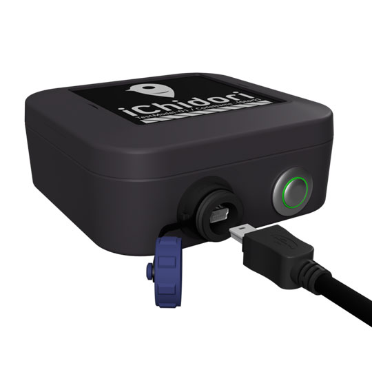
Built-in battery
By incorporating a battery in the device, the device can operate continuously for up to about 15 hours (our measurement) without a power source.
Customizable
Various parts from devices to systems can be customized according to the customer's usage and requests.
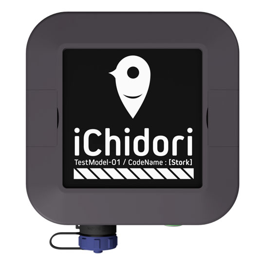
Waterproof compact model with integrated antenna and built-in battery
iChidori-Stork is a compact receiver with a built-in antenna and battery. It is also water-resistant and can be used in a wide range of situations.
"Anytime, anywhere" in the palm of your hand.
A 15-hour battery and dual-frequency antenna are built into a palm-sized device. This compact GNSS receiver can be used for positioning anytime, anywhere.
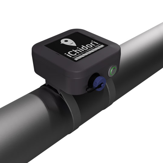
Compact and waterproof for various environments
The waterproof (IP66) and outdoor-fixable housing (mounting band sold separately) can be used safely in a variety of environments, from simple land area measurement to outdoor object monitoring.
- GPS: L1, L2
- GLONASS: L1PT, L2PT
- Galileo: L1, E5b
- Beidou: B1, B2
Easy to use centimeter-level location information with the apps.

iChidori-Measure
Measurement of azimuth and area can be performed using centimeter-level location information. Measurement of land area, distance, and orientation can be easily carried out using only a smartphone and device.
Go to Support Page
iOS only
iChidori-Tracker
Tracking (trajectory drawing) can be done using centimeter-level location information. It can be easily implemented using only a smartphone and a device.
Go to Support Page
iOS only

iChidori-Guide
Geo-fence data can be read and centimeter-level location information of GNSS receiver devices can be used for real-time display of device location information and location-triggered notifications.
Go to Support Page
iOS only
We will customize iChidori® to suit your needs.
iChidori® can be customized to meet your needs and usage. Various customizations are available for hardware, mobile applications, and cloud applications.
Our staff will listen to your requirements and propose the best configuration for you. Of course, we can also provide support for the installation of a dedicated base station. Please feel free to contact us.