
iChidori-Guide Support
What you can do with "iChidori-Guide"
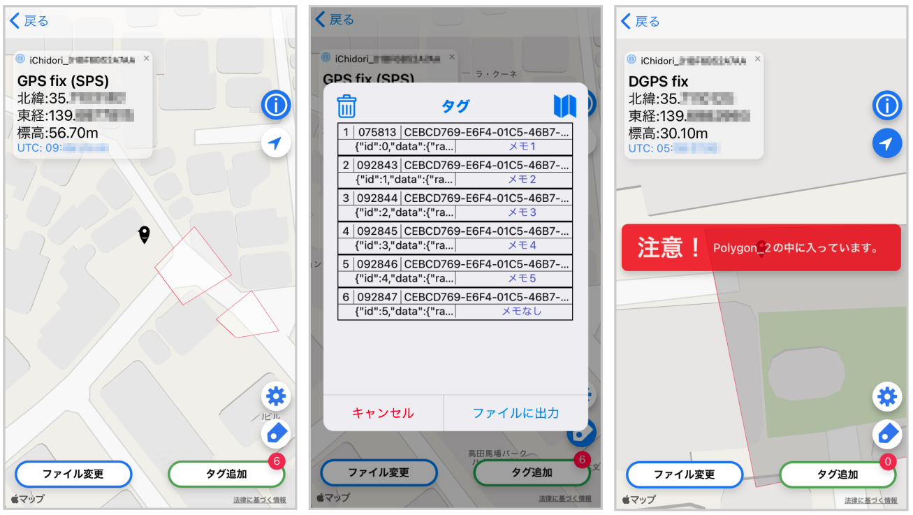
You can load geofence data (GeoJSON) created by GIS software, etc., and use the detailed centimeter-level positioning information obtained by the GNSS receiver device iChidori to do the following.
- Real-time display of device location information on a map loaded with geo-fence data
- Notification function triggered by geofence and real-time location
- Tag recording function
- Data output of tag record information (GeoJSON format)
This application requires the iChidori device developed by AITOYA Inc. Please note that the application cannot be used by itself.
This service is designed for home (personal) use. It cannot be used for business purposes (such as sales transactions of goods or other proof of sight).
iChidori-Guide Tips
Terms of Use
Use in a location with good reception of radio waves
To obtain more detailed location information, please use the device outdoors and in an environment where it can easily receive satellite signals. If the device is behind a building or object, or if the device is oriented incorrectly (with the antenna facing the sky), it may not be possible to acquire location information for the measurement point.
It takes time to receive the data.
Once the iChidori device is connected to the iChidori device, it will start receiving and analyzing radio waves. It may take some time (30 seconds to a few minutes) before the iChidori device begins to acquire and respond to the measurement information.
Error Reference Values
The status will appear in the information window of the Map screen.
- GPS fix (SPS): Approx. 10m to 20m
- DGPS fix: about several meters
- Float RTK: Approx. 10 cm to several meters
- Real Time Kinematic: about 2 cm