iChidori-Tracker Support
What you can do with "iChidori-Tracker"
It connects to iChidori, a GNSS receiver device, and allows tracking (trajectory drawing) using detailed location information from centimeter-class positioning.
This application requires the iChidori device developed by AITOYA Inc. Please note that the application cannot be used by itself.
This service is designed for home (personal) use. It cannot be used for business purposes (such as sales transactions of goods or other proof of sight).
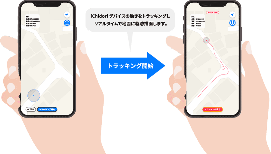
- Real-time drawing of iChidori device movement trajectory on a 2D map
- Latitude and longitude measurements (north latitude and east longitude/seventh decimal place for each)
- Distance (in meters, to the second decimal place)
- Elevation (in meters, to two decimal places)
iChidori-Tracker Tips
Terms of Use
Use in a location with good reception of radio waves
To obtain more detailed location information, please use the device outdoors and in an environment where it can easily receive satellite signals. If the iChidori device is behind a building or object, or if the device is not oriented correctly (antenna facing the sky), it may not be possible to obtain location information for the measurement point.
Depending on the satellite reception time of the iChidori device, it may take some time (30 seconds to several minutes) to respond.
Reference values for error
During reception, the following characters indicate the status of location information acquisition.
Type of status and error reference values
- GPS fix (SPS): Approx. 10m to 20m
- DGPS fix: about several meters
- Float RTK: Approx. 10 cm to several meters
- Real Time Kinematic: about 2 cm